In Norwich we often see slope issues that aren't obvious until you put a digger in the ground. The city sits on a mix of Cretaceous chalk, Crag sand and thick layers of glacial till – materials that react very differently when you cut into them. A lot of the housing estates pushing up towards the NDR and the Wensum valley slopes where re-grading is planned catch people out. You get a dry summer, the till shrinks, then autumn rain saturates the fissures and a shallow slip plane develops within hours. Our slope stability analysis isn't a desktop exercise. We tie the BS 5930 site investigation directly to limit-equilibrium modelling, run back-analysis on any existing slumps, and factor in the Norfolk groundwater regime that rises faster than most engineers expect. Before finalising a cut geometry, many projects combine our triaxial testing on undisturbed chalk samples to pin down effective cohesion and friction angle for the actual strata on site.
In Norwich's valley slopes, assuming peak strength on weathered chalk or fissured till is the fastest route to a failure – we back-analyse every existing slip before committing to a design.
Methodology applied in Norwich
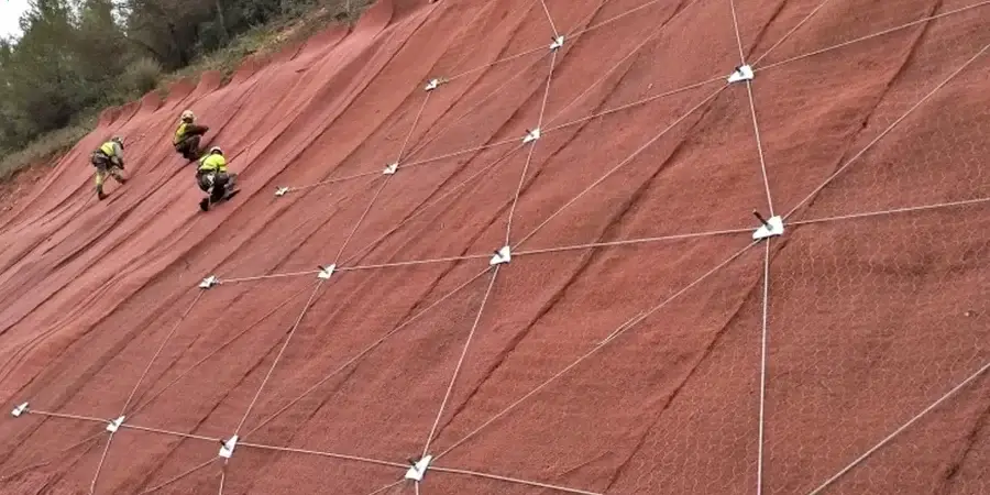
Local geotechnical conditions in Norwich
We run the slope stability analysis on a dedicated workstation using Rocscience Slide2 and sometimes a custom Python wrapper for Monte Carlo sensitivity runs – not a general-purpose spreadsheet. The real risk in Norwich isn't the algorithm; it's the input. If the till's preconsolidation pressure is guessed rather than measured, the modelled factor of safety can be off by 20 percent or more. We have seen a 4-metre cut in Crag sand stand unsupported for six months and then slump overnight after two days of steady rain, simply because the suction that was holding the face dissipated. That's why we insist on piezometer data. For permanent slopes, we also check the undrained re-consolidation scenario, because Norwich's chalk can act as a confined aquifer and push pore pressures up into the base of the till. The output is a clear, auditable report that a CDM Principal Designer can use without a PhD in soil mechanics, backed by our UKAS-accredited lab data.
Our services
Every slope stability analysis we deliver for Norwich projects is built on two pillars that keep the numbers grounded in reality.
Detailed site investigation for slope assessment
Cable percussion and rotary cored boreholes through chalk, till and Crag, with in-situ SPTs, undisturbed U100 sampling and standpipe or vibrating-wire piezometer installation. The logging follows BS 5930 and targets the exact strata that control stability: fissure spacing in till, chalk weathering grade, and sand density. Lab testing runs from quick undrained triaxial to ring shear on polished slickensided surfaces for residual strength, giving the slope model parameters that reflect the ground as it is, not as the textbook says it should be.
Limit-equilibrium modelling and design recommendations
We build 2D limit-equilibrium models across the most critical cross-sections, incorporating the measured groundwater profile and fully-softened or residual strength envelopes where the geology demands it. The report includes deterministic and probabilistic outputs, sensitivity to perched water, and practical recommendations for regrading, drainage, toe berms or structural retention. For projects within the Norwich City Council area, we align the drainage advice with the Lead Local Flood Authority requirements so the slope solution doesn't create a new flooding problem downstream.
Questions and answers
What slope failures are most common in the Norwich area?
Shallow translational slides in weathered Lowestoft Till are the number one issue, usually triggered by prolonged rainfall in autumn and winter. We also see rotational failures in the chalk putty layer just above intact chalk, especially where old chalk pits have been backfilled and then re-graded for housing. River Wensum valley slopes occasionally show deeper seated movements where the Crag sand acts as a confined aquifer and pressurises the base of the till. Our analysis always tests for all three mechanisms.
Do I need a slope stability analysis for a domestic extension on a sloping plot in Norwich?
If the slope is steeper than about 1 in 6 and you are cutting within 6 metres of the crest, Building Control will almost always ask for a geotechnical assessment. A full slope stability analysis might be overkill for a small cut, but we can run a simplified Bishop analysis with conservative parameters to confirm the factor of safety exceeds 1.3 for the temporary condition. That is usually enough to satisfy the warranty provider and keep the project moving.
What is the typical cost range for a slope stability analysis in Norwich?
For a single cross-section with existing ground investigation data, the analysis and report typically fall between £1,040 and £1,850 depending on complexity and time needed for back-analysis. A multi-section assessment for a larger development, including probabilistic analysis and liaison with the design team, usually runs from £2,200 to £3,530. The spread reflects how much lab testing and piezometer data we already have.
How long does a slope stability assessment take once the site investigation is complete?
With lab results and piezometer readings in hand, a single-section deterministic analysis with a full interpretive report can be turned around in seven to ten working days. If we need to run a sensitivity study across multiple sections or incorporate probabilistic analysis, allow another week. We can often supply preliminary stability comments within three days to keep an earthworks programme from stalling.